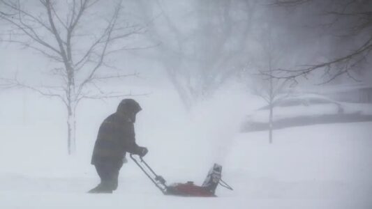

A major winter storm is bearing down on the New York City area and much of the Tri-State region, with forecasters warning of heavy snowfall, gusty winds, and tough travel conditions starting Sunday and stretching into Monday. The National Weather Service office in New York put out a Winter Storm Watch late Friday afternoon, covering Sunday morning through Monday afternoon. In their update posted on X, they highlighted the risk of significant snow across the region. Areas farther east and nearer the coast could see blizzard-like conditions, complete with strong winds that make visibility poor and driving hazardous.
New York City Mayor Zohran Mamdani shared the city’s preparations in a post on X, laying out what residents can expect. He said the forecast calls for 6 to 8 inches of snow on Sunday, followed by another 1 to 3 inches on Monday.
City crews are already gearing up, plows are being mounted, salt spreaders loaded, and sanitation workers shifting to 12-hour rotations starting Sunday. More than 5,000 Department of Sanitation staff will be out around the clock to clear streets.
City Response and Safety Measures
Mamdani stressed that no one will be turned away from shelter during the storm. A Code Blue alert is in place, meaning outreach teams will patrol all five boroughs nonstop to help vulnerable people get inside warm spots. If you spot someone who looks like they need assistance in the cold, just dial 311. He also reminded folks to stay updated by texting NotifyNYC to 692-692 or checking nyc.gov/beready for the latest alerts.
What the Storm Could Bring
This weather system looks set to deliver its heaviest punch from Sunday night into early Monday morning. Expect periods of intense snow that could drop visibility quickly, especially with wind gusts topping 40 mph near the shore. That combination often leads to blowing snow and very dangerous road conditions, think slippery highways, delayed buses and trains, and potential power outages if branches come down under the weight. Coastal spots might also deal with some flooding where tides run high.
Right now, confidence is building that New York City will see at least 6 inches of accumulation, though totals could shift depending on exactly how the storm tracks. The map from the NWS shows the watch area stretching across much of the region, from White Plains and New York City out to places like Montauk, Islip, and even up toward Groton and Bridgeport.
Folks in the Tri-State should keep an eye on updates over the next day or two, storms like this can still adjust their path. Stock up on essentials, charge devices, and plan to limit travel if possible during the worst of it Sunday night through Monday morning. Stay safe out there.